


At least two tornadoes touched down in Kentucky on Thursday.
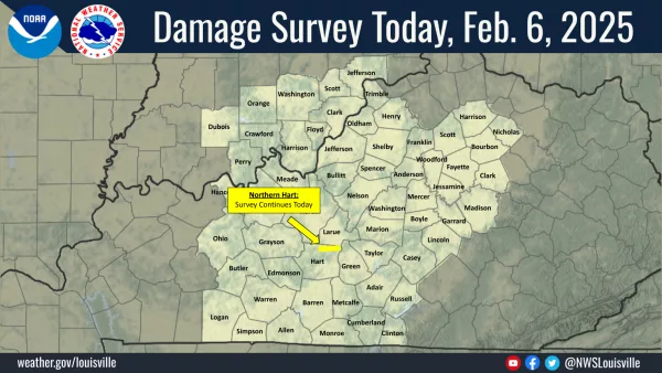
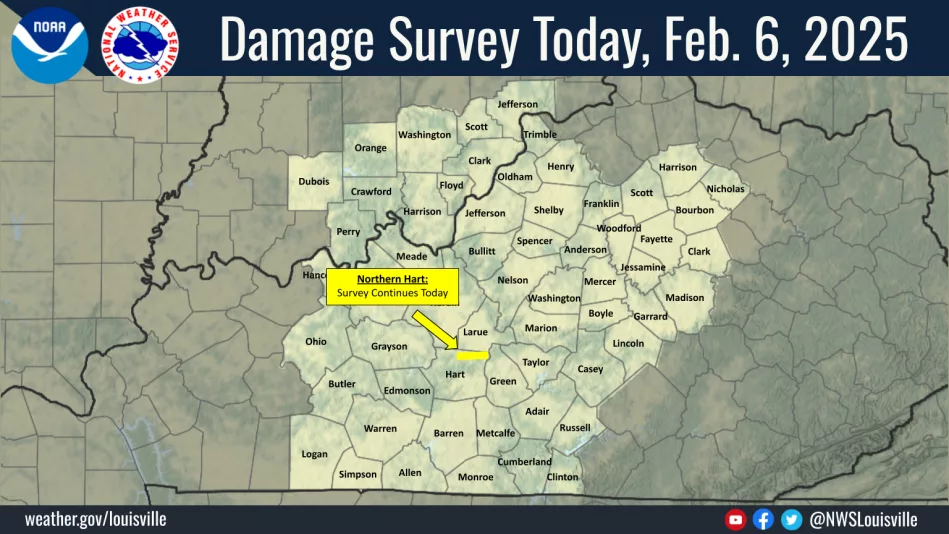
The National Weather Service (NWS) in Louisville reports an EF-1 twister packing winds up to 95 miles per hour touched down in neighboring (northern) Hart County, near the LaRue County line, on Thursday morning. It appears, according to the NWS, that the tornado was on the ground for less than a minute.
NWS tornado survey crews arrived in Hart County on Thursday afternoon to ascertain the damage caused by the twister.
A tornado also touched down in Rockcastle County at approximately 8:00 a.m. Thursday, the NWS determined. Two homes and a barn suffered damage.
Tornado warnings were rampant in Kentucky during the overnight and early morning hours, as warnings were issued in at least Ohio, Edmonson, Butler, Hardin, Hart, Casey, Marion, Green, LaRue, Lincoln, Rockcastle, Jackson, Owsley, and Taylor counties.
Grayson County was placed under a tornado warning at approximately 4:04 a.m. Thursday after a radar indicated twister was determined to be just west of Caneyville, traveling east toward Leitchfield. As of Thursday evening, there’s no indication the tornado touched down in Grayson County.
Grayson County’s tornado warning was initially set to expire at 4:30 a.m. but just a few minutes prior to the expiration the warning was extended to 5:00 a.m.
In addition to Hart and Rockcastle counties, NWS damage assessors were in Owsley and Jackson counties on Thursday, as both counties reported damage.
By Ken Howlett, News Director
Contact Ken at ken@k105.com