The airplane that crashed in Ohio County late Wednesday night, killing the flight instructor and student pilot, appears to have flown directly into a severe thunderstorm that developed over two hours prior to the crash.
Dustin Knight, a Leitchfield native who studied meteorology at WKU and who works as a Decision Support Specialist-Weather Forecaster, and has a formal education in aviation meteorology, analyzed pertinent weather data and found that the single-engine Piper PA 28-161 flew directly into a severe thunderstorm.
Killed in the crash were 22-year-old Eagles View Aviation flight instructor Timothy “Junior” McKellar, of Custer, and 18-year-old student pilot, Connor W. Quisenberry, of Beaver Dam. The flight originated at the Bowling Green-Warren County Airport with its destination the Owensboro-Daviess County Regional Airport.
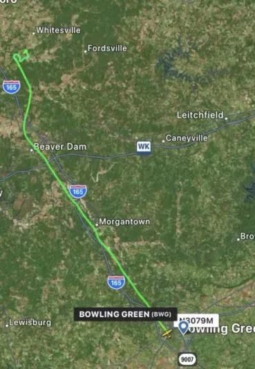
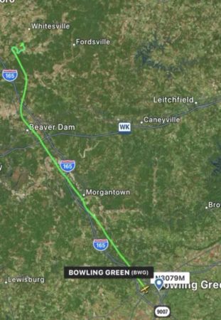
The aircraft fell off radar at approximately 10:55 p.m. CDT, as the Evansville Regional Airport notified Daviess County Central Dispatch of a possible plane crash in the area. The crash site was just southwest of Whitesville near Desserter Creek (see the flight path of the aircraft below).
“My analysis utilized weather radar, satellite, METAR weather station data, and ground reports from personnel responding to the incident,” Knight told K105
Knight’s analysis shows that at 8:09 p.m., isolated storm cells initiated near Paducah, moving to the east/northeast as it grew in size and intensity.
“These will be the storms that impact the plane crash site at the time the air traffic control tower loses contact later,” Knight said.
At 9:09 p.m., a strong storm passed to the northeast of Whitesville, clearing the area by 10:00 p.m. At 10:13 p.m., Knight said the storms that developed near Paducah moved into Calhoun “with very heavy rain, severe wind gusts, and hail occurring.”
“Radar imagery indicated 60-65 dbz reflectivity at this time, which is supportive of very heavy rain and hail, both aloft and at the surface,” Knight noted.
At 10:45 p.m., the leading edge of a gust front, which was producing strong wind gusts ahead of the storm, moved into Whitesville.
“Radar signatures at the time indicate very heavy rain, hail aloft, and severe winds were ongoing,” according to Knight.
Furthermore, Knight noted that “velocity radar data (which allows experts to assess winds within the storm) indicated strong wind was surging into the rear section of the storm and being forced downward toward the surface in a downburst.”
“This,” Knight stated, “would have produced strong downward motion in the vicinity of Whitesville as well as very turbulent conditions nearby.”
“Strong to severe conditions were ongoing in and around Whitesville,” according to Knight, “including where the plane wreckage was found, from 10:36-10:57 p.m. before the storm exited the area to the east. This storm had been approaching from the west for over two hours with little deviation in its track and did not ‘rapidly develop’ in the area.”
Strong storms were forecast by local National Weather Service meteorologists, Knight said, as well as broadcast and private sector forecasters/meteorologists.
“The Storm Prediction Center in Norman, Oklahoma, had outlined western and central Kentucky for the potential for scattered thunderstorms, some of which may be severe with damaging wind and hail the likely hazards,” Knight said.
The NTSB, which has yet to formally release a preliminary accident report as of time of publication, is investigating.
(Headline photo: Still photo of the flight path of the Piper aircraft)
By Ken Howlett, News Director
Contact Ken at ken@k105.com


